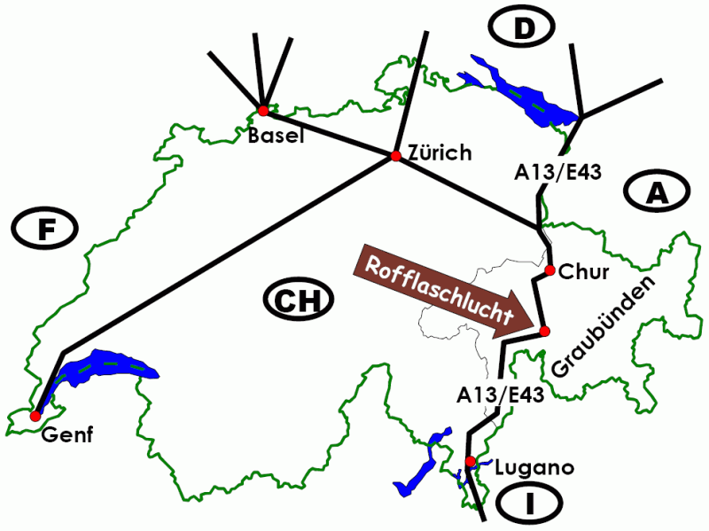
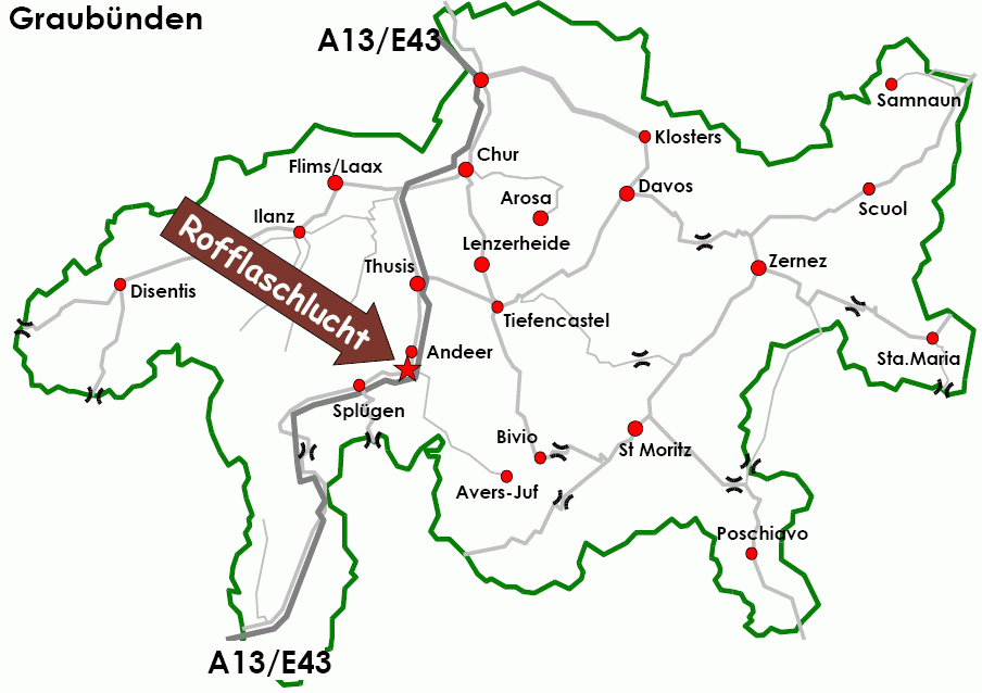
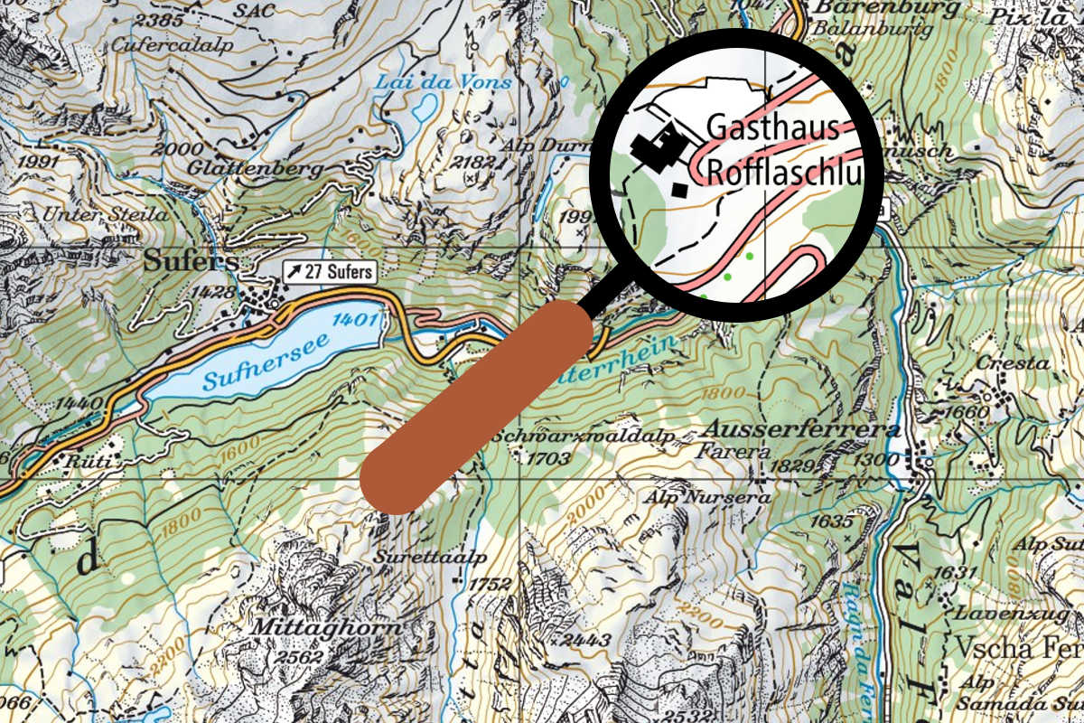
Getting there: You can reach us via the A13 / E43. Exit Avers-Rofla (NR26). Then follow the brown "Roflaschlucht" -signs. Approximately 500m from the exit. Detail ->
GPS: 46°34'55.04'' N width; 9°25'16.79'' E length Height: 1100 meters above sea-level
Rofflaschlucht or Roflaschlucht? On road maps Roflaschlucht is mostly written with only one "f". We write it with 2 "f" (Rofflaschlucht). However, both are referring to the same location.